







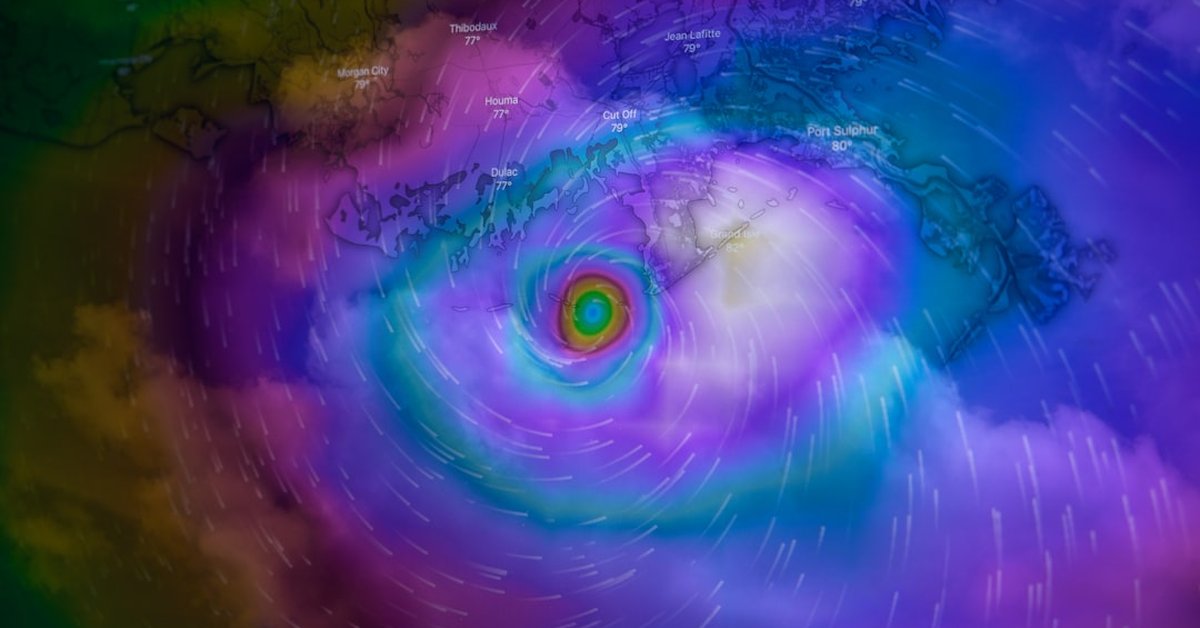
When Super Typhoon Bavi barreled into the Northern Mariana Islands and Guam on July 14, 2026, it wasn’t just another storm. It was the third category 5 tropical cyclone of the year — a grim milestone that has climate scientists and disaster planners paying close attention. With sustained winds of 180 mph (290 km/h) and gusts exceeding 210 mph, Bavi tore through the island chain, leaving a trail of destroyed homes, snapped power lines, and flooded runways. This is not normal. And it’s getting worse.
Look, we’ve seen powerful typhoons before. But three category 5s in a single Pacific season? That’s unprecedented in the satellite era. The previous record was two, set in 2015. Bavi’s arrival has forced a reckoning with what a warming planet means for the millions of people living in the typhoon belt.
The Scale of the Destruction
Bavi first made landfall on the island of Saipan at 2:00 AM local time, packing winds equivalent to a strong EF5 tornado — but spread across a 30-mile-wide eye. The storm surge reached 20 feet in some coastal areas, inundating villages that had been rebuilt after Typhoon Soudelor in 2015. On Guam, the island’s main power grid collapsed within hours. The U.S. military’s Andersen Air Force Base reported a record barometric pressure drop to 892 millibars, one of the lowest ever recorded in the Western Pacific.
“We’ve never seen anything like this,” said Dr. Maria Santos, a climatologist at the University of Guam, in an interview. “The intensity and the rapid intensification — Bavi went from a tropical storm to a category 5 in less than 36 hours. That’s a hallmark of very warm ocean waters.”
And the ocean waters are indeed warm. Sea surface temperatures in the region were running 1.5°C to 2°C above the 1991–2020 average, according to NOAA satellite data. That extra heat is fuel for storms. It’s like throwing a log on a fire — the bigger the log, the bigger the blaze.
A Year of Extremes
Bavi didn’t emerge in a vacuum. 2026 has already seen a record-breaking heatwave in the UK with temperatures hitting 36°C, wildfires in Utah, and a surprising boom in deep-sea life due to melting Arctic ice. The interconnectedness of these events is hard to ignore. The same planetary warming that bakes London also juices typhoons in the Pacific.
But let’s not pretend there’s a simple straight line. Climate change doesn’t cause every storm, but it loads the dice. Dr. James Chen, a meteorologist at the Joint Typhoon Warning Center in Pearl Harbor, put it bluntly: “The probability of a category 5 forming in July has increased by about 40% since the 1980s. Bavi is exactly what the models have been warning us about.”
Meanwhile, the debate over energy policy continues. Some argue that fossil fuel expansion won’t materially affect the climate — a claim that was recently made by the owner of the Jackdaw gas field. But the science is clear: every ton of CO2 adds to the heat budget. And the heat budget is now overflowing.
What Happens Next?
As of July 16, Bavi is moving west-northwest at 12 mph, skirting the Philippines and heading toward Taiwan and mainland China. The storm is expected to weaken slightly as it enters cooler waters, but it’s still a major threat. China has already evacuated 1.2 million people from coastal provinces. Hong Kong’s stock exchange is closed. The economic toll could exceed $50 billion.
For the islands that were hit first, recovery will take years. The Northern Mariana Islands are a U.S. territory, so federal aid is flowing, but the damage is staggering. On Tinian, 80% of structures are damaged or destroyed. The airport on Saipan is a soup of debris and saltwater.
“We’re used to typhoons,” said a local resident quoted by the Associated Press. “But this one was different. It felt like the island was shaking.”
And here’s the uncomfortable truth: Bavi is likely not the last category 5 of 2026. The Pacific typhoon season runs through November. With sea surface temperatures still anomalously high, the ingredients for more monster storms remain in place. A Reuters analysis of climate models suggests that the frequency of category 4 and 5 storms in the Western Pacific could double by 2050 if emissions continue unchecked.
So what does this mean for you? If you live in the typhoon belt, it means updating your disaster kit and paying attention to evacuation orders. If you live elsewhere, it means recognizing that the price of inaction is being paid by real people, right now. The storms don’t care about politics. They only care about the heat.
Frequently Asked Questions
What made Super Typhoon Bavi so intense?
Bavi underwent rapid intensification over waters that were 1.5–2°C warmer than normal. This allowed the storm to go from a tropical storm to a category 5 in just 36 hours. A record low pressure of 892 millibars was recorded, indicating extreme strength.
How does Bavi compare to previous record-breaking typhoons?
Bavi is the third category 5 typhoon of 2026, surpassing the previous record of two in 2015. Its sustained winds of 180 mph tie it with Typhoon Haiyan (2013) and Typhoon Goni (2020) as some of the strongest storms ever observed.
Is climate change responsible for Bavi?
While no single storm can be directly attributed to climate change, warmer ocean temperatures and higher atmospheric moisture — both linked to human-caused warming — increase the likelihood of storms reaching category 5 intensity. The probability of a July category 5 has increased by 40% since the 1980s.